

Cava di Maso - Consolidation of the north rock face - Bari (BA) - Italy
2015-2017
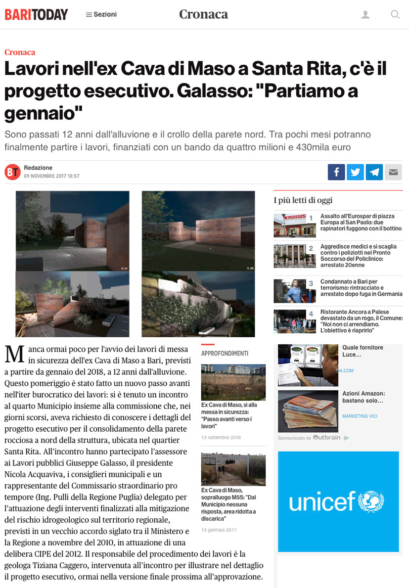
The intervention concerns the consolidation of the northern rock face of the former Maso Quarry, located in the Santa Rita - Carbonara 2 district of the Municipality of Bari. The project, drafted in a Temporary Association of Professionals (A.T.P.) with the firm Romanazzi Boscia e Associati S.r.l. of Bari, won a public tender and is currently being implemented.
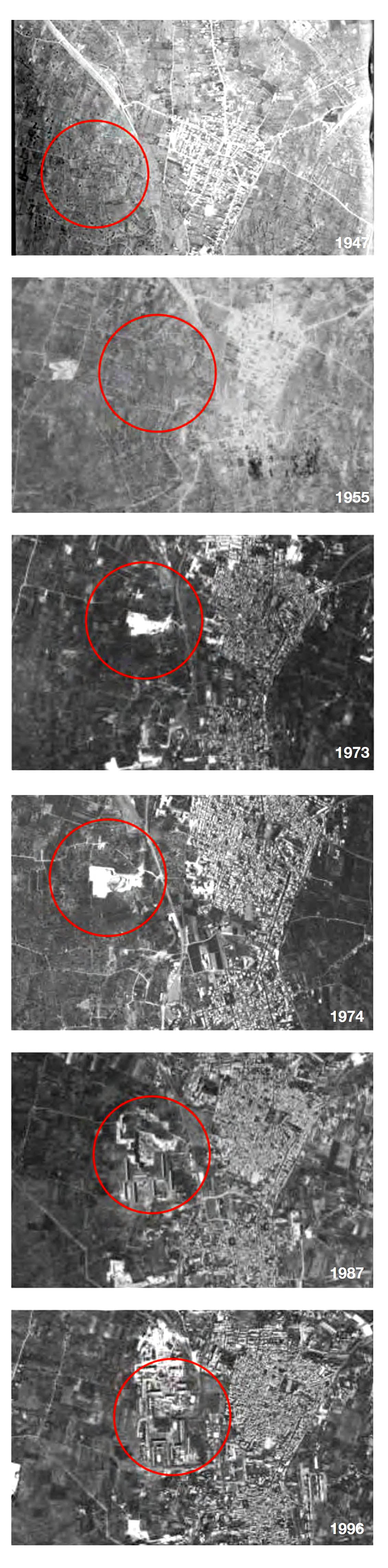
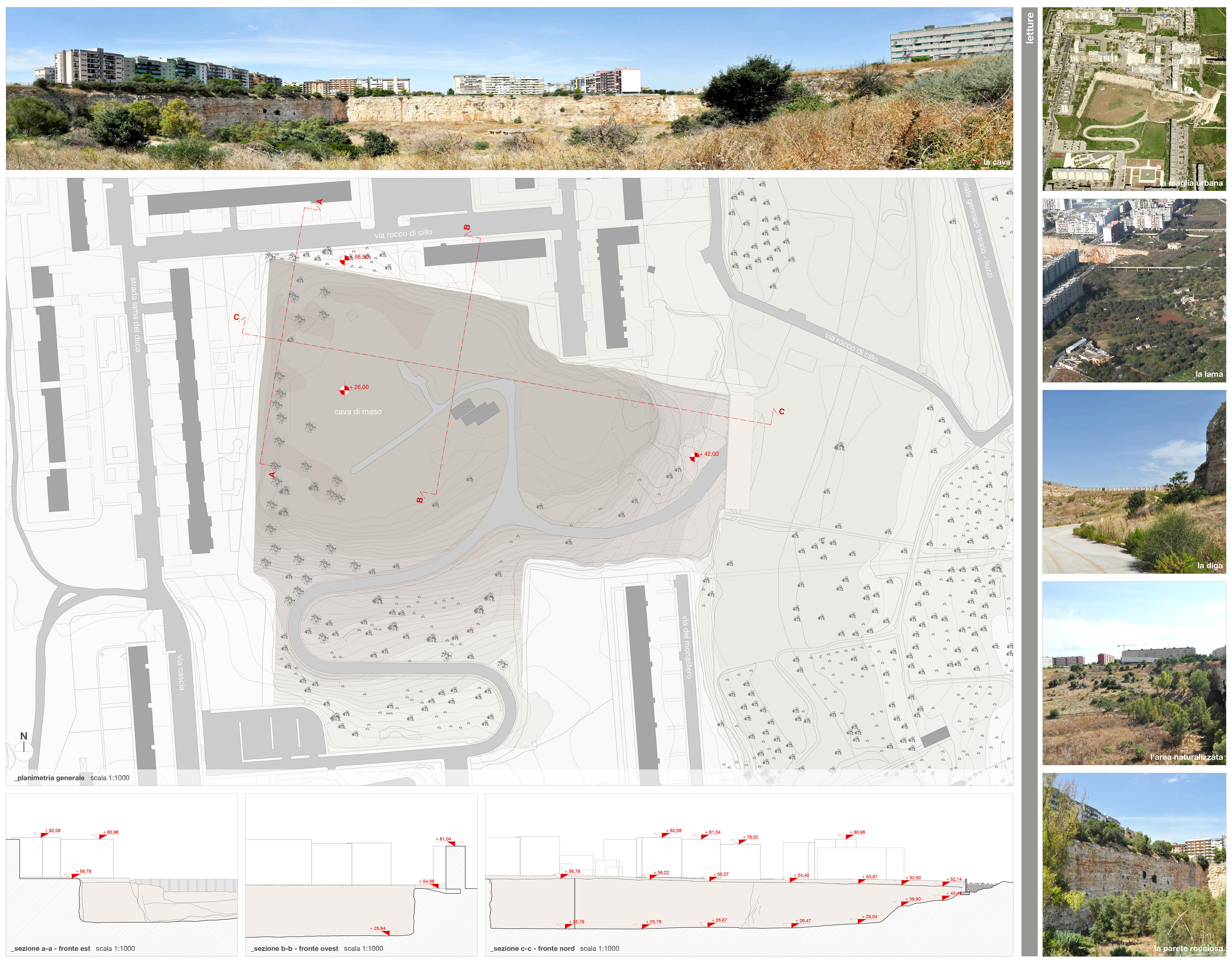
The former Maso quarry covers an area of approximately 65,000 sqm and is characterized by walls ranging in height between 24 and 30 meters. It has the shape of an irregular, roughly rectangular polygon formed between 1960 and 1984 as a result of quarrying activities that began precisely from the northern wall, which is the object of these interventions. Both the northern and western walls still retain the natural characteristics resulting from the quarrying activity. The eastern side is characterized by a massive reinforced concrete wall built, following a severe flood in recent times, for water containment and regulation. The southern side now appears naturalized and modified compared to the original configuration of the quarry, partly due to the construction of its access road.
In the immediately adjacent areas, on the northern, western, and southern fronts, buildings ranging from 8 to 10 stories high were subsequently constructed, forming one of the cores of the Santa Rita district. The eastern front, where the bed of the Picone Torrent and the diversion channel (which flows slightly further north into the final stretch of the Lamasinata Torrent) can be seen, offers a more open view and a panorama over the territory.
The geotechnical study preliminarily provided the volumetric specifications for the embankment, which was identified as the optimal and unavoidable solution to structurally guarantee the consolidation of the northern wall. This was the starting point for the necessity and the desire to transform an engineering requirement—of undeniable impact on the site and the landscape—into an opportunity for redevelopment with urban, landscape, and environmental value.
The goal was to seek solutions capable of preserving the memory of the site, even from a morphological point of view, as it was shaped by the anthropogenic activities linked to the quarrying.
Consequently, the project aims to develop in multiple directions:
- Enhancing the morphological characteristics of the site;
- Preserving the signs and conserving the memory of the place;
- Enhancing the landscape features (panoramic views);
- Integrating with the recently formed urban context;
- Creating a recreational area serving the neighborhood;
- Environmental remediation;
- Creating a new scenario and ensuring complementarity with future functional redevelopment interventions of the quarry;
- Sustainability during the execution phase of the intervention;
- Sustainability for future management.
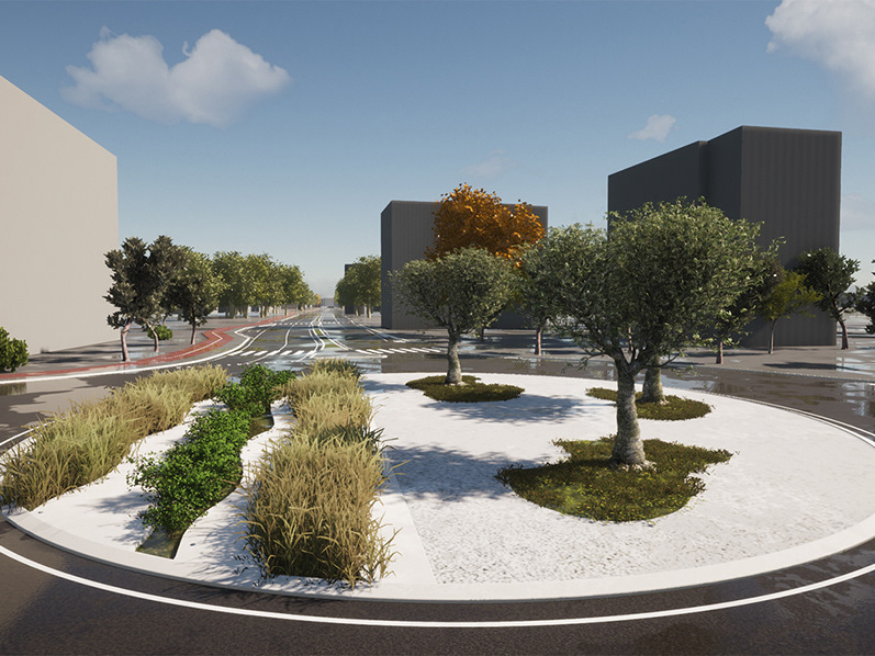
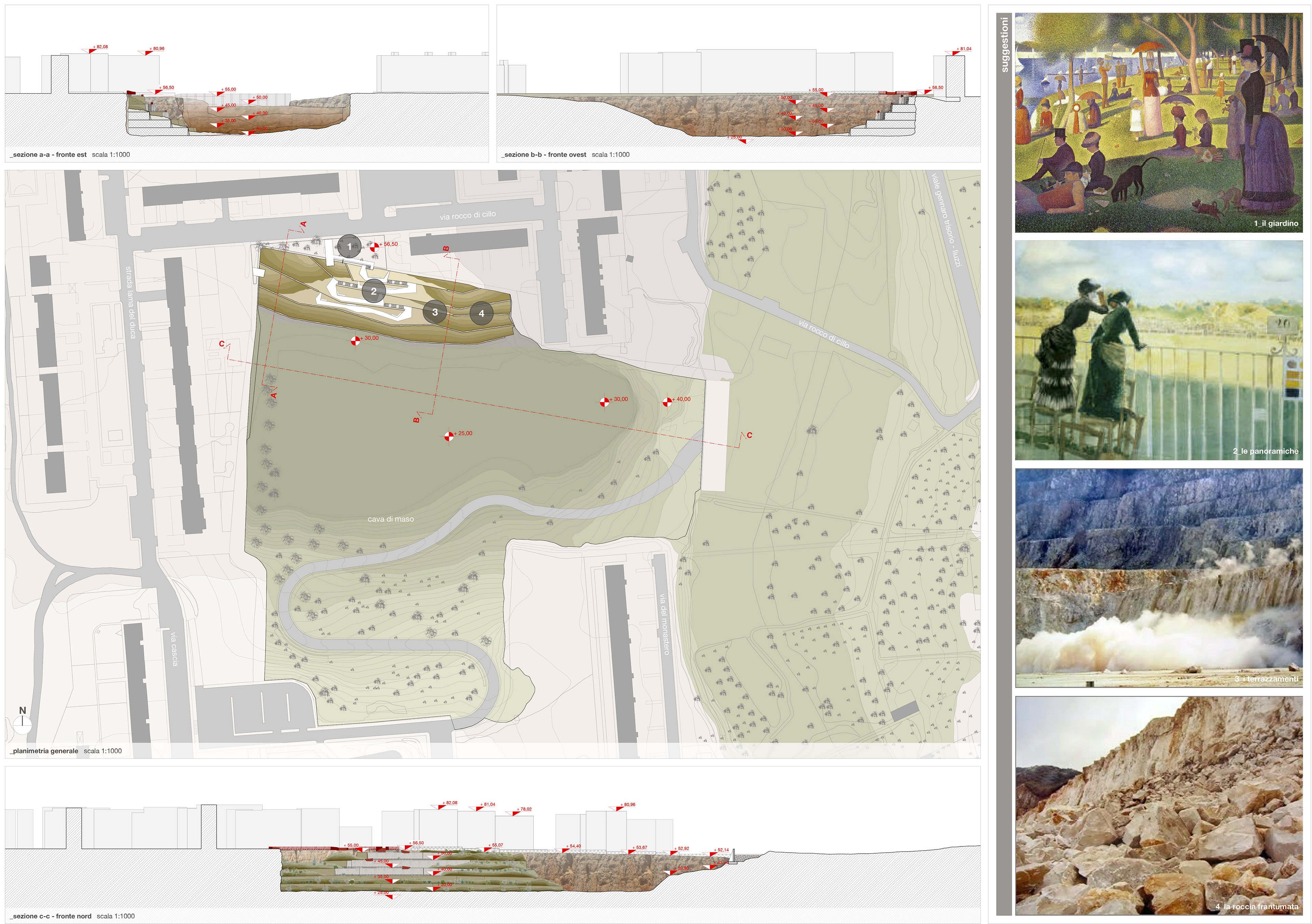
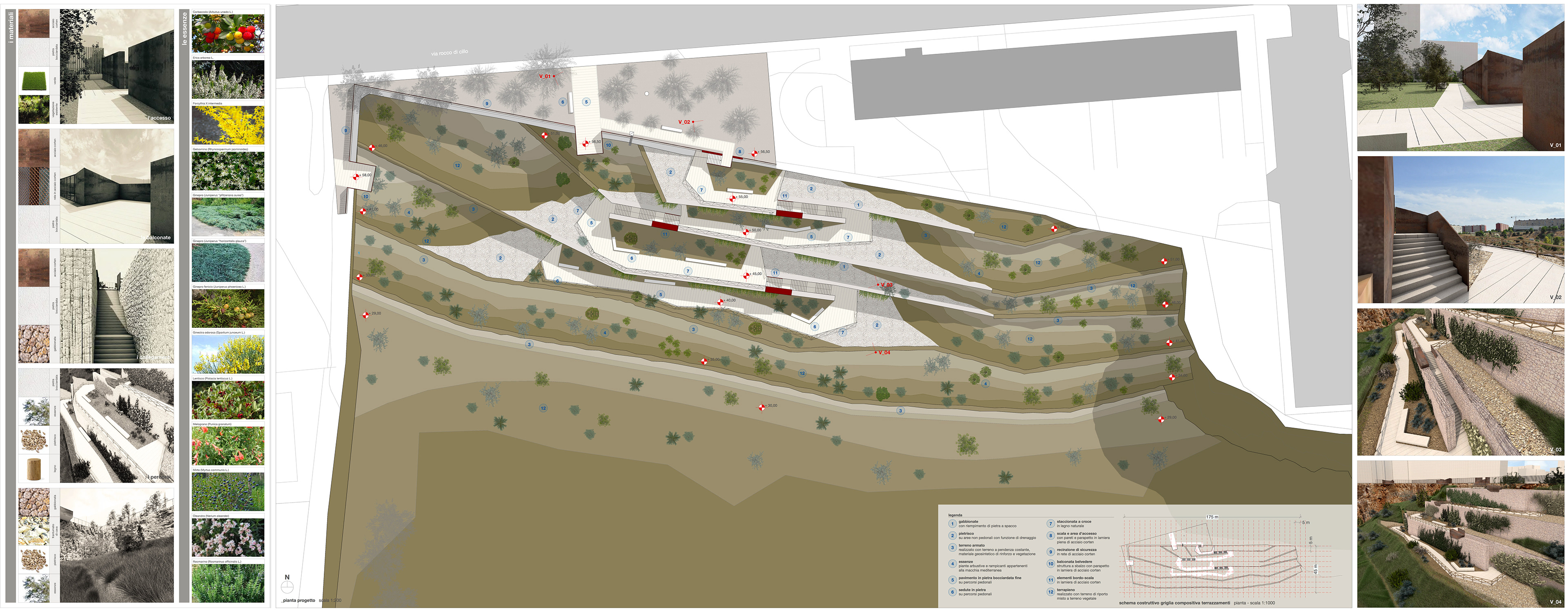
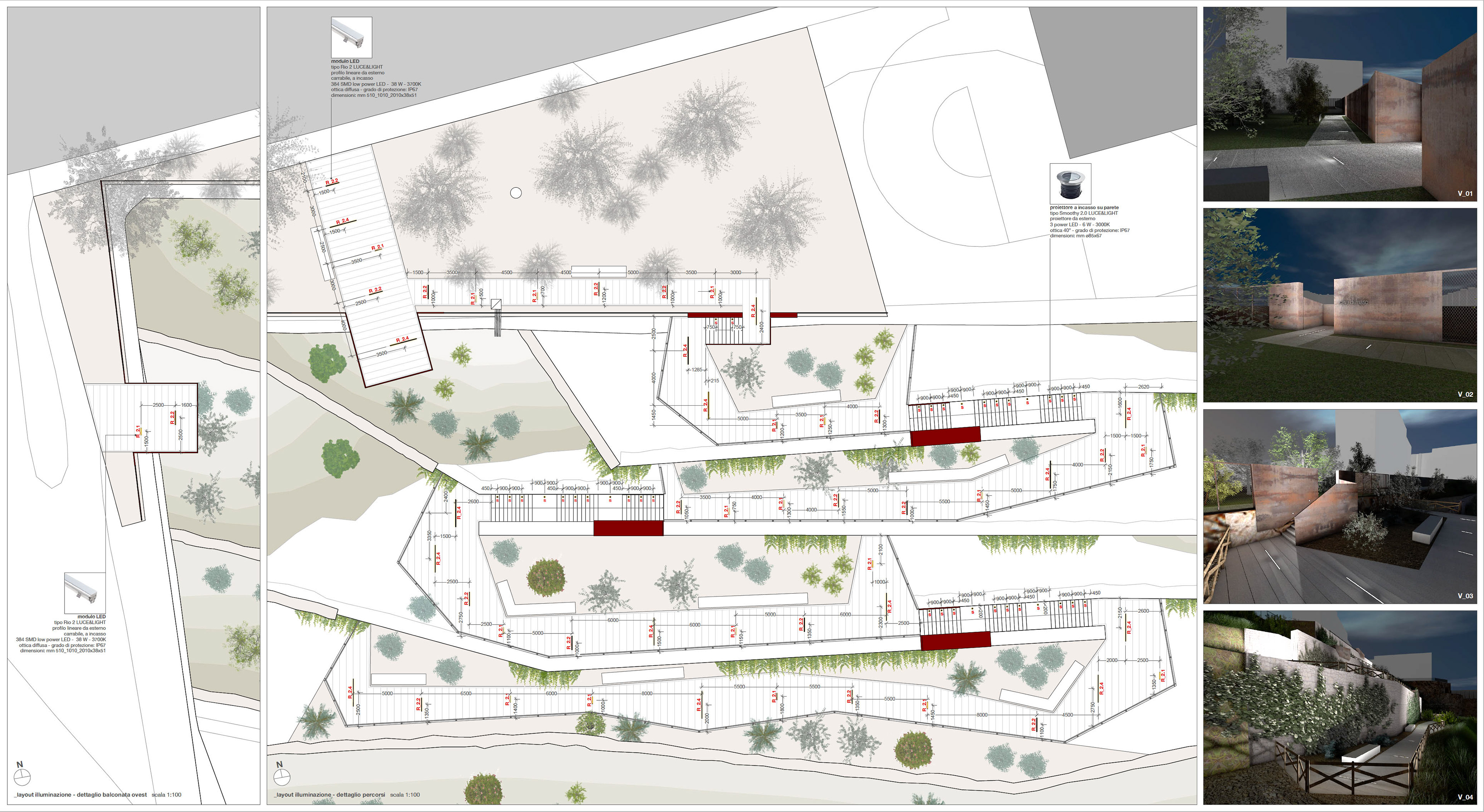
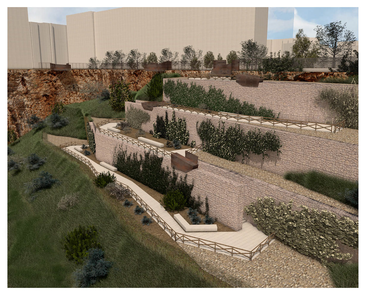
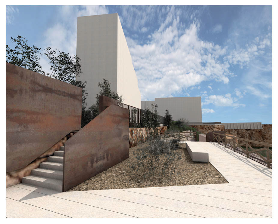
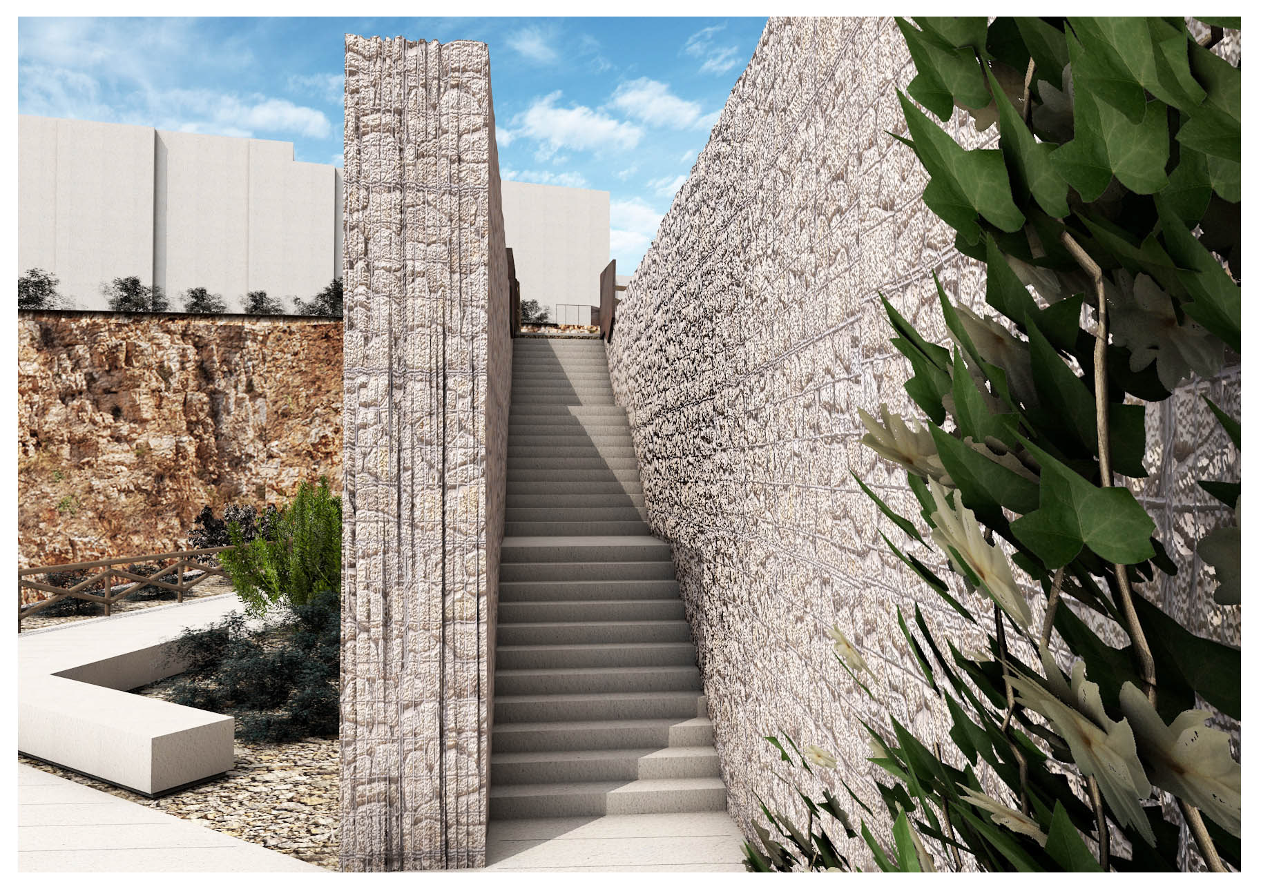
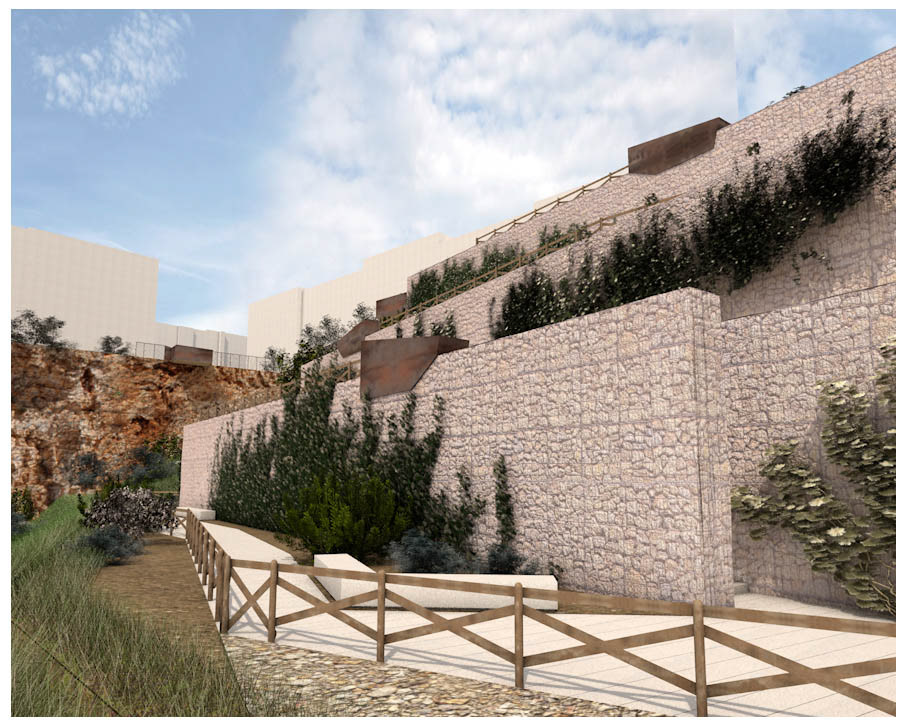
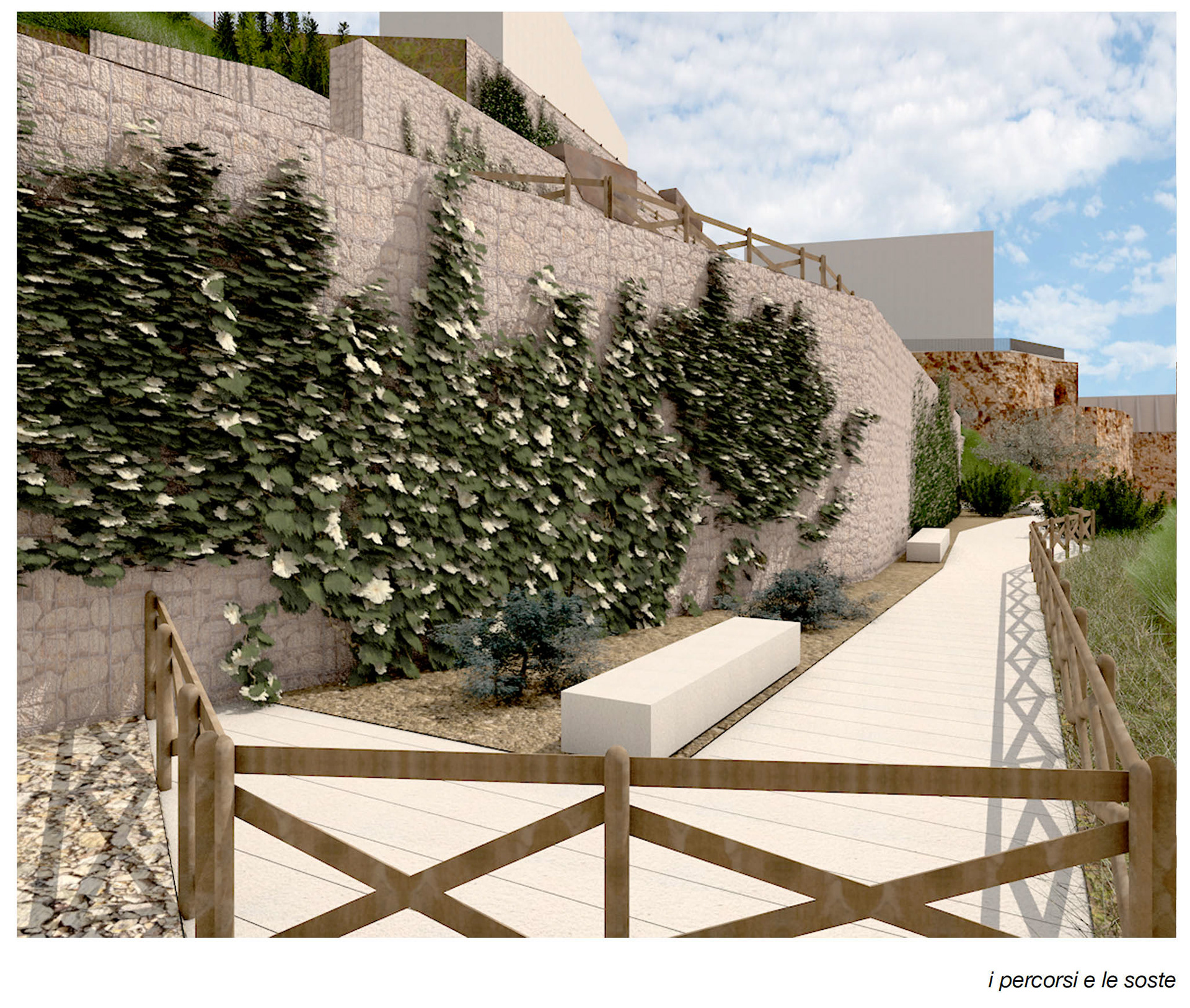
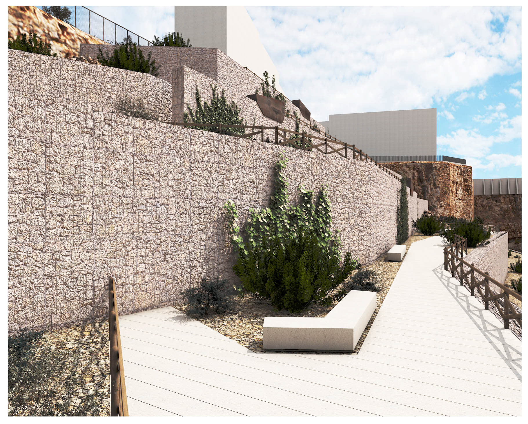
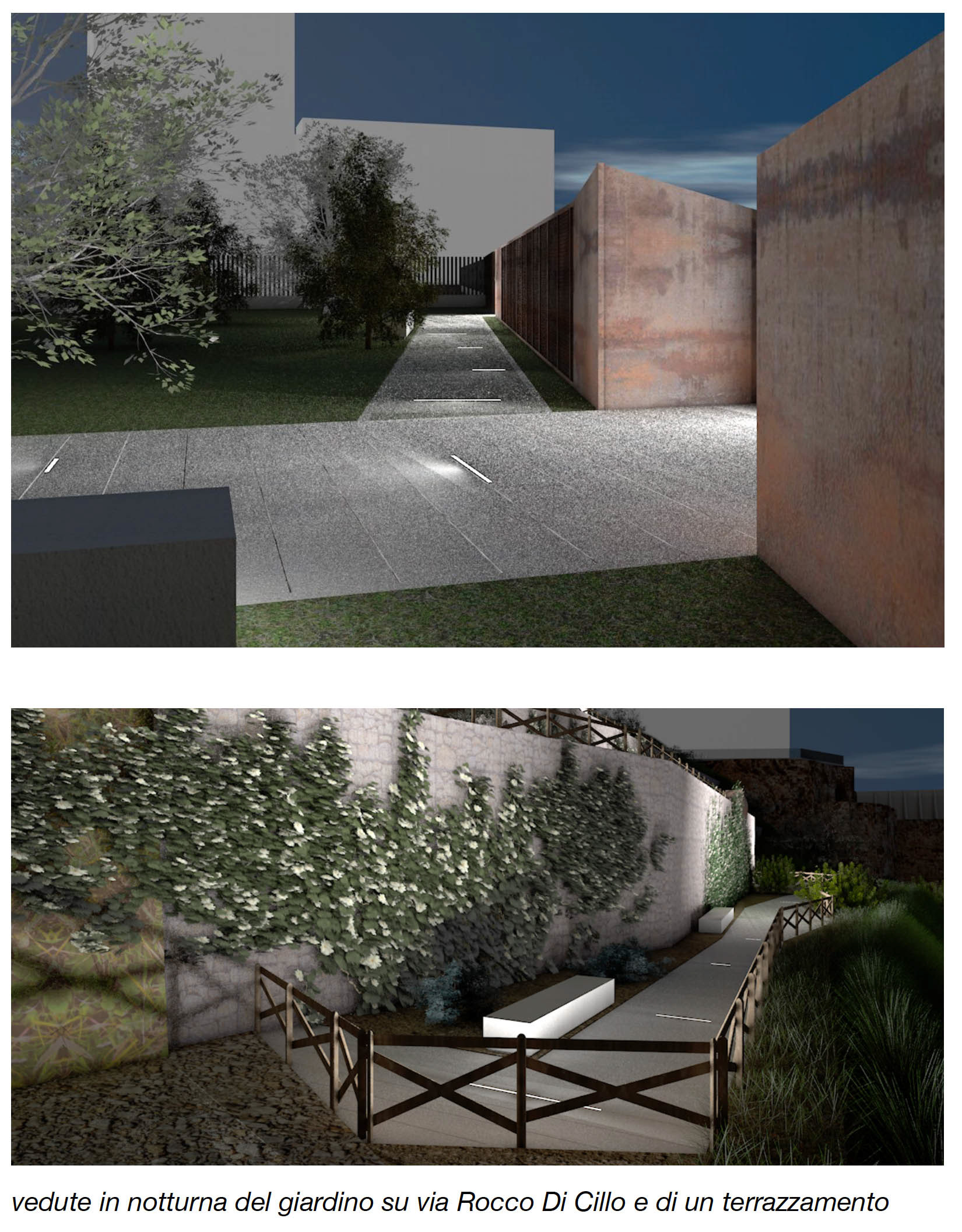
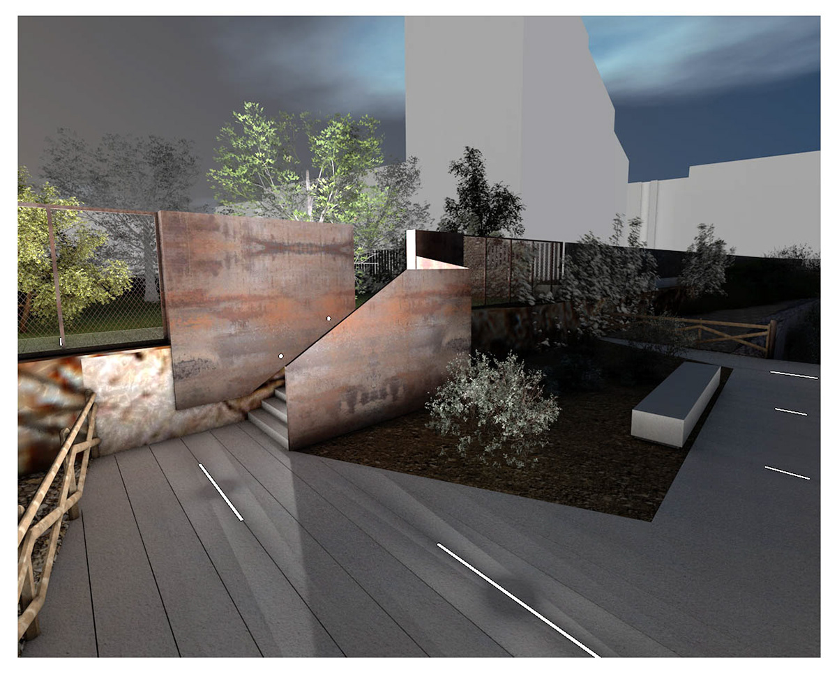
The design of the embankment, planned for the structural consolidation of the former quarry's northern wall, is thus transformed into a new opportunity to redevelop an area that appears totally abandoned. It becomes functional to the regeneration of the entire Santa Rita neighborhood by connecting the inner area of the quarry to the built grid through a garden area that acts as a hinge, positioned to overlook the surrounding territory.
The proposed intervention consists of two macro-areas:
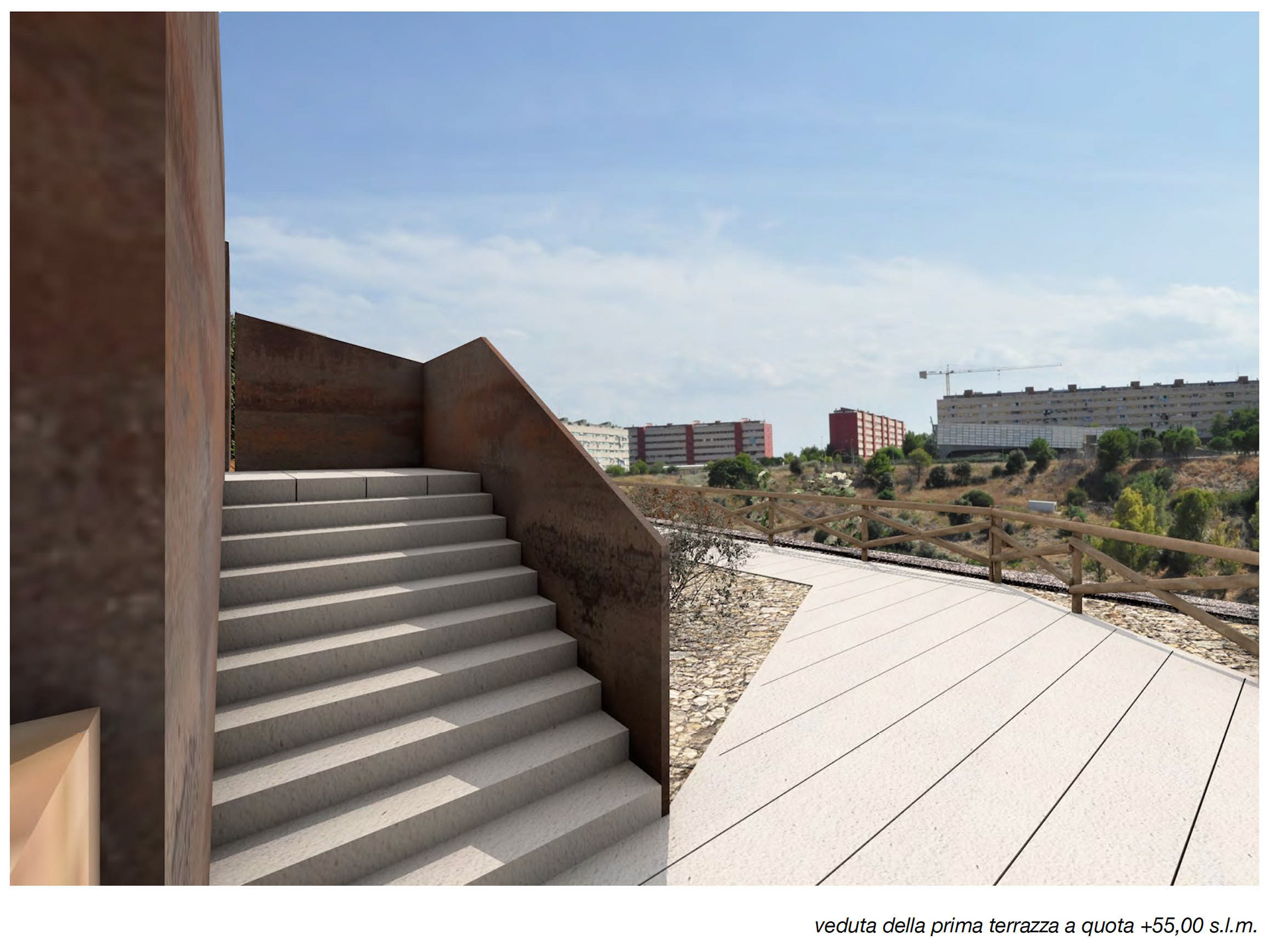
- The arrangement at street level (+55.00 m above sea level);
- The interventions on the embankment (from +55.00 m to +25.00 m above sea level).
These contribute to the formation of three distinct contexts with different but interconnected morphological and functional characteristics:
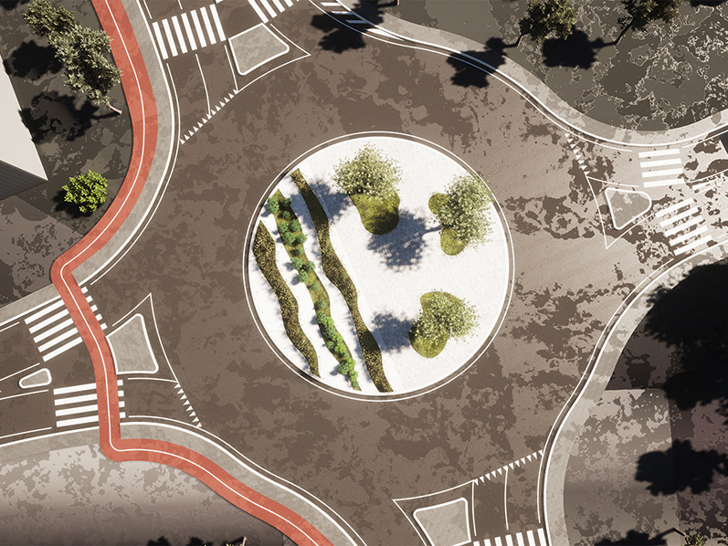
- The gateway: featuring panoramic views;
- The promenade: terraces with seating and rest areas;
- The natural environment: the quarry.
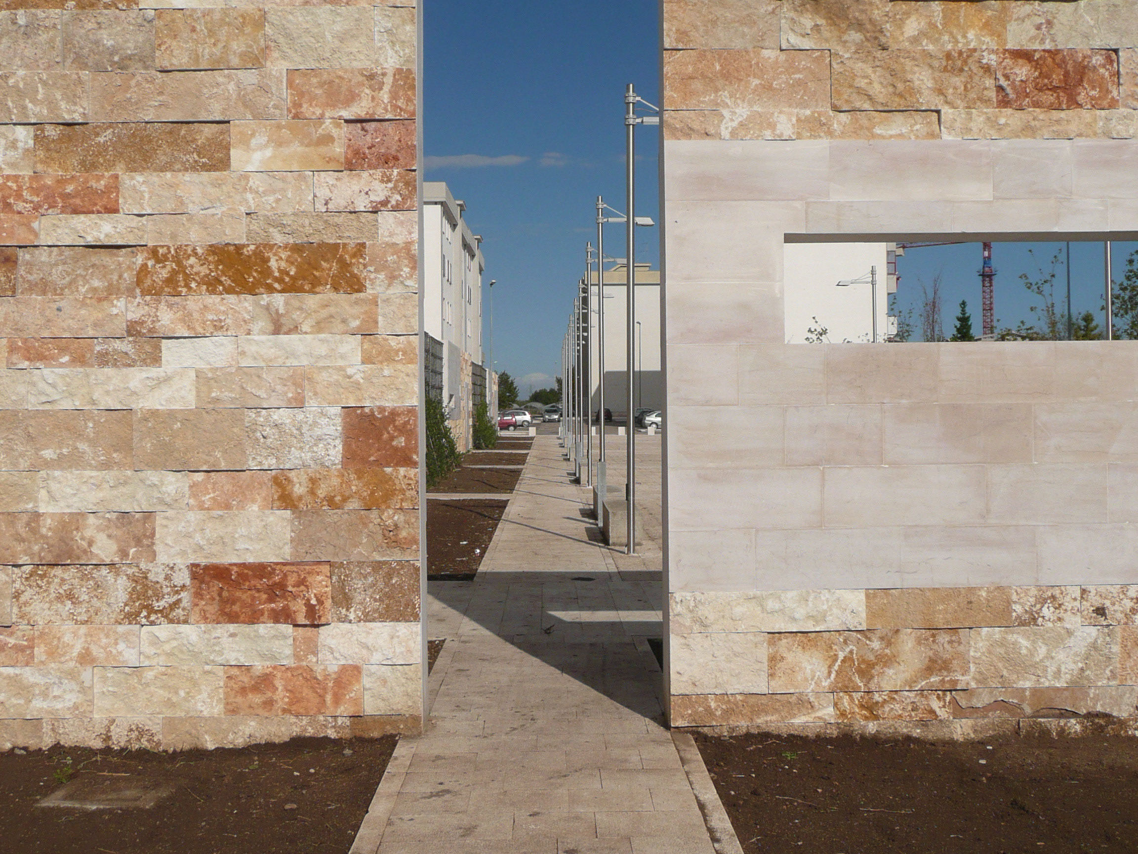
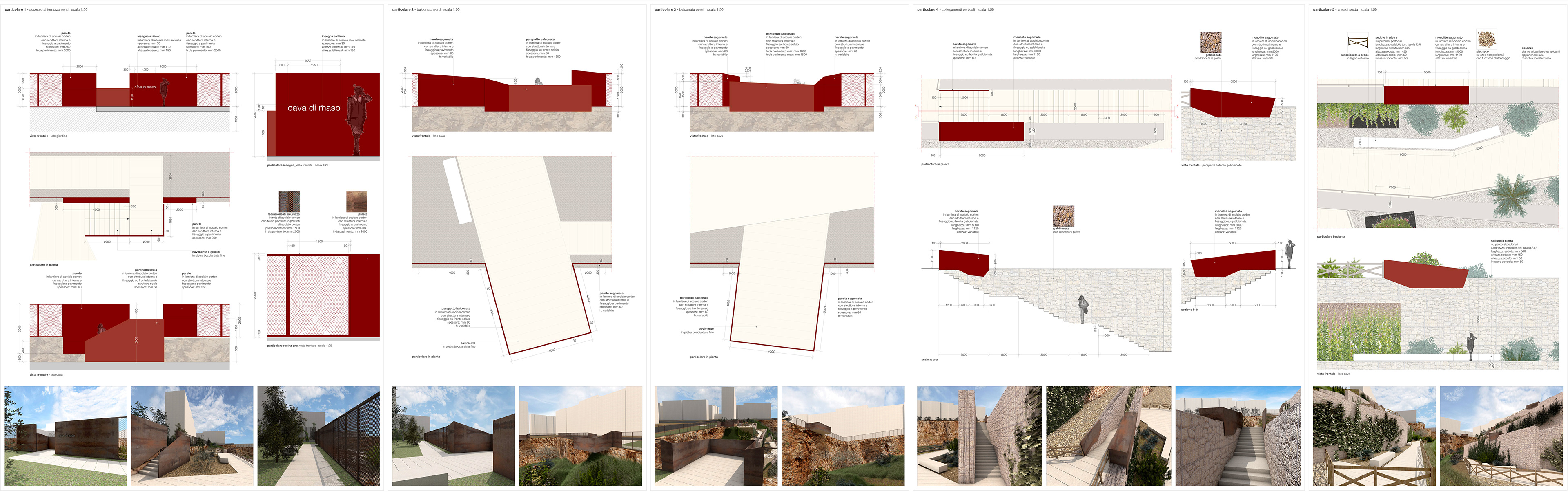
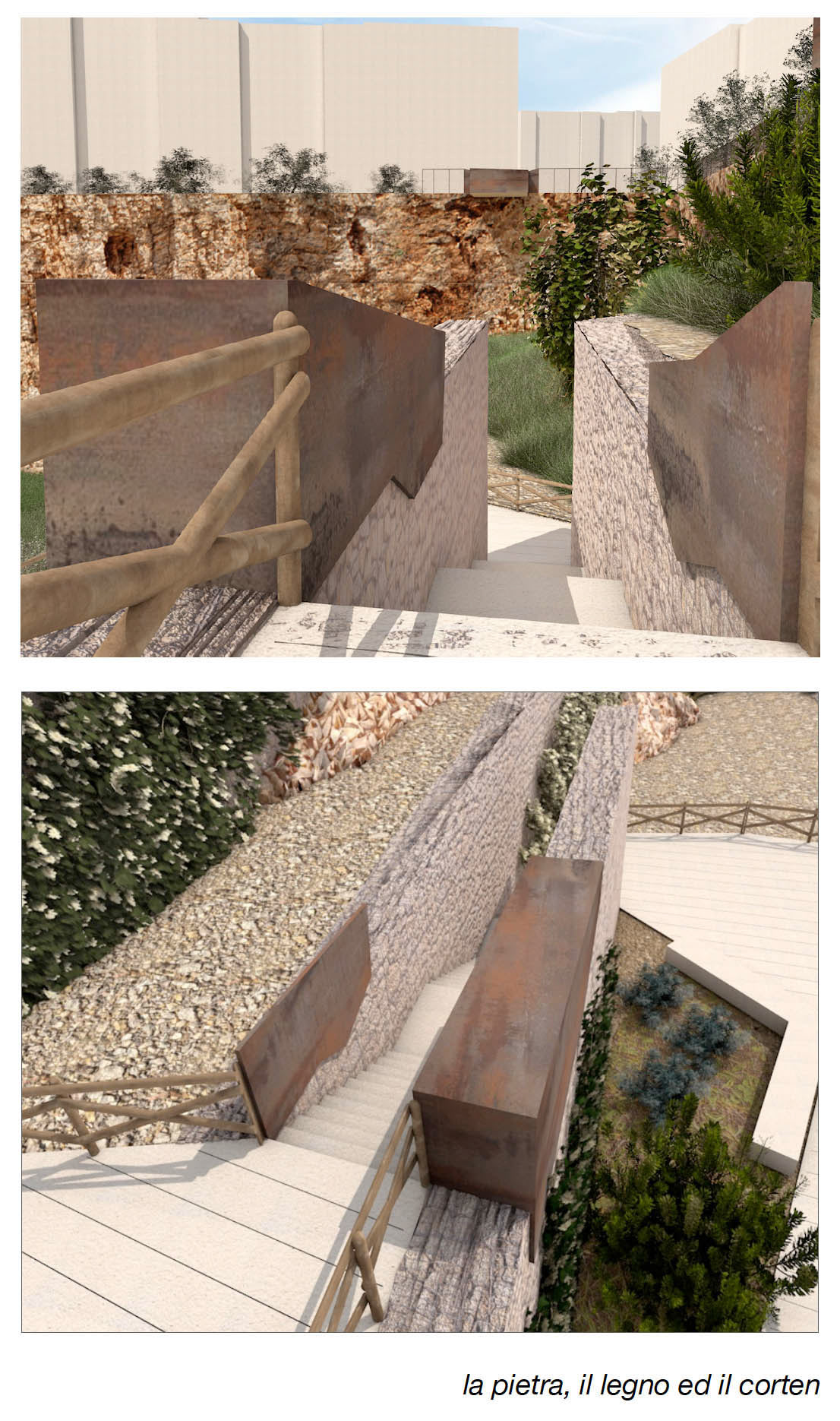
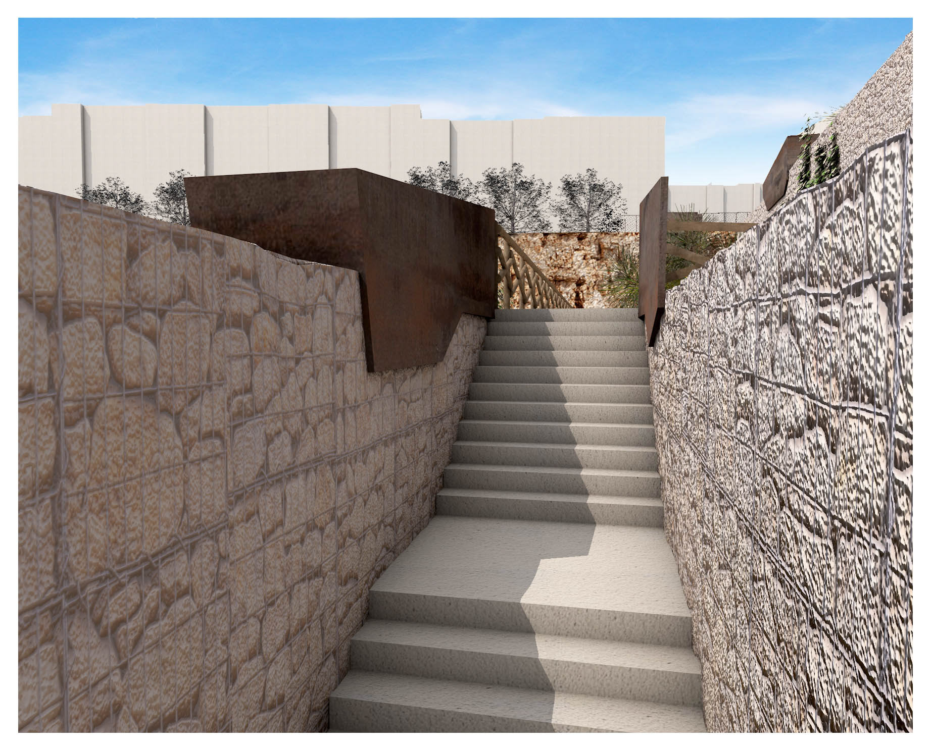
Each of the three designated areas suggested distinct design hypotheses regarding layout and architectural configuration. Highly interconnected, they are also united by a single design language concerning the choice of materials (wood, stone, and Corten steel) suited both to the natural habitat and to the one shaped by the now-historic quarrying activity.
The creation of an accessible path with rest areas implicitly leads to imagining this place as a sort of neighborhood park.
CLIENT: Ufficio del Commissario Straordinario Delegato per l’attuazione degli interventi per la mitigazione del rischio idrogeologico nella Regione Puglia - ITALY
DESIGN: arch. Vincenzo Russo, Studio Romanazzi Boscia Associati S.r.l. (ingg. E. Romanazzi, G.F. Boscia, S. Giotta, F. Paccapelo), Piacentini Ingegneri S.r.l., ing. Nicola Tafuni, ing. Paolo Greco, ing. Antonio Siano, dott. Mario Frate, Dott.ssa Lucia Ceci
COMPANY: Nicola Daloiso S.r.l., Margherita di Savoia (BT), Modomec Ecoambiente S.r.l., Massafra (TA)
LOCATION: Bari (BA) - ITALY
YEAR: 2017
La Repubblica